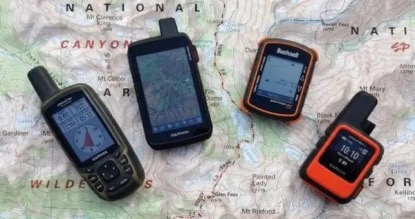
Expert-tested & reviewed GPS units with multi-band GNSS accuracy, satellite messaging, and preloaded topo maps.
We focus on real-world navigation performance, battery life, and durability for hiking, backpacking,
and off-grid expeditions.
Your smartphone's GPS works great in the city, but when you're deep in a canyon, under dense tree canopy,
or days away from a charging outlet, dedicated handheld GPS units remain the gold standard. Modern devices
combine multi-band GNSS technology with ruggedized builds, preloaded topographic maps,
and battery life measured in weeks rather than hours. The best units now include inReach satellite
messaging for two-way text communication and SOS anywhere on Earth.
🔬 How We Research: We evaluate GPS devices through hands-on experience, detailed specification analysis, and aggregated user feedback across varied terrain conditions.
Extensive field experience with hands-on evaluation
10 models analyzed head-to-head
Real accuracy data from verified user reports
Cold weather patterns documented from owner feedback
Not sure which GPS is right for you? Answer a few quick questions and we'll recommend the best handheld GPS for your specific needs.
1. What's your primary use case?
2. Do you need satellite messaging (SOS & texting)?
Satellite messaging lets you send texts and trigger SOS anywhere on Earth—requires a subscription (plans vary by tier)
3. What's your budget?
4. How important is weight?
🏆 Premium Handheld GPS Devices ($500+)
These top-tier devices offer the best accuracy, battery life, and feature sets available. They're built for
serious adventurers who demand reliable navigation and satellite communication in challenging conditions.
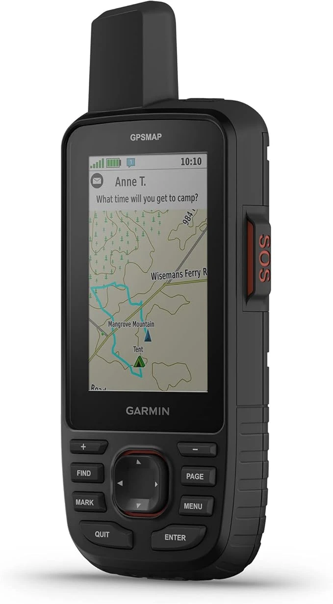
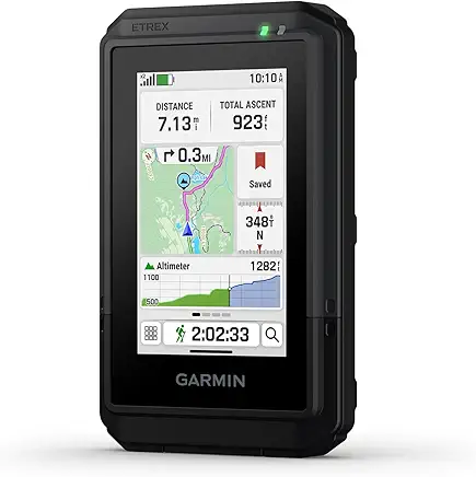
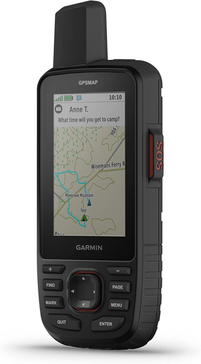
The GPSMAP 67i is our top pick for serious backcountry navigation. Its quad-helix antenna and multi-band GNSS
(GPS, Galileo, GLONASS, BeiDou, QZSS, IRNSS) deliver exceptional accuracy even under heavy tree canopy. The 180-hour
battery life (840 hours in Expedition mode) supports long trips, and the built-in inReach satellite messaging
provides two-way texting and SOS capability far beyond cell coverage.
Display: 3.0" color transflective (240×400px), excellent sunlight readability
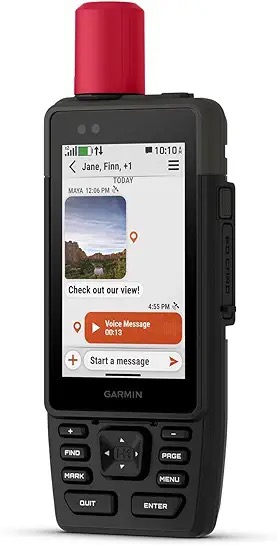
The GPSMAP H1i Plus is positioned as a bleeding-edge handheld for high-consequence teams. It combines a larger hybrid
touchscreen/button interface with advanced satellite communication features, aiming to support richer off-grid
communication workflows in addition to navigation.
Display: 3.5" color touchscreen + buttons (chemically strengthened glass)
Battery: 145 hours with SatIQ, 840 hours Expedition mode
Weight: 10.2 oz (289g)
GNSS: Multi-band GPS/Galileo/BeiDou/QZSS with SatIQ power management
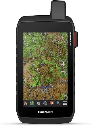
The Montana 700i's massive 5" touchscreen (480×800px) makes it one of the easiest GPS units to read detailed maps on.
It's built for vehicle mounting (UTVs, ATVs, boats, overlanding rigs) where screen real estate matters. It includes
inReach satellite messaging for two-way texting and SOS.
Display: 5.0" color touchscreen (480×800px), glove-friendly
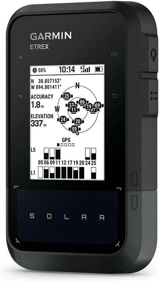
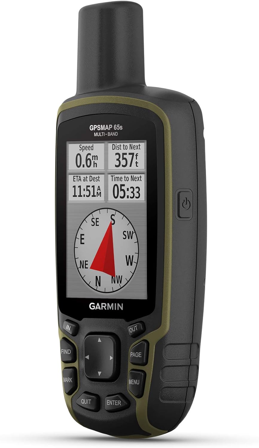
The GPSMAP 65s brings multi-band GNSS accuracy to a compact, affordable package. With ABC sensors (altimeter,
barometer, compass), this button-operated workhorse delivers strong positioning performance in challenging terrain.
It's ideal if you want premium navigation without paying for satellite messaging features.
Display: 2.6" color transflective (160×240px)
Battery: 16 hours (2 AA batteries)
Weight: 7.7 oz (217g) with batteries
GNSS: Multi-band GPS/GLONASS/Galileo/QZSS/IRNSS
Satellite Comms: None (navigation only)
Memory: 16GB internal + microSD slot
Durability: IPX7 waterproof
Field take: One of the best "pure navigation" handhelds for harsh weather and gloved use—AA-powered simplicity for long trips.
Pros
Multi-band accuracy at a lower cost than inReach models.
AA batteries make resupply simple for long routes.
Tactile button controls excel in cold/wet conditions.
Cons
No satellite messaging/SOS.
Smaller screen than Montana series.
Verdict: The best pick for top-tier accuracy without subscriptions.
A compact multi-band handheld that prioritizes reliable navigation and gloved usability.
These devices offer excellent value with strong core features. They're ideal for regular hikers and
outdoor enthusiasts who want reliable navigation without premium pricing.
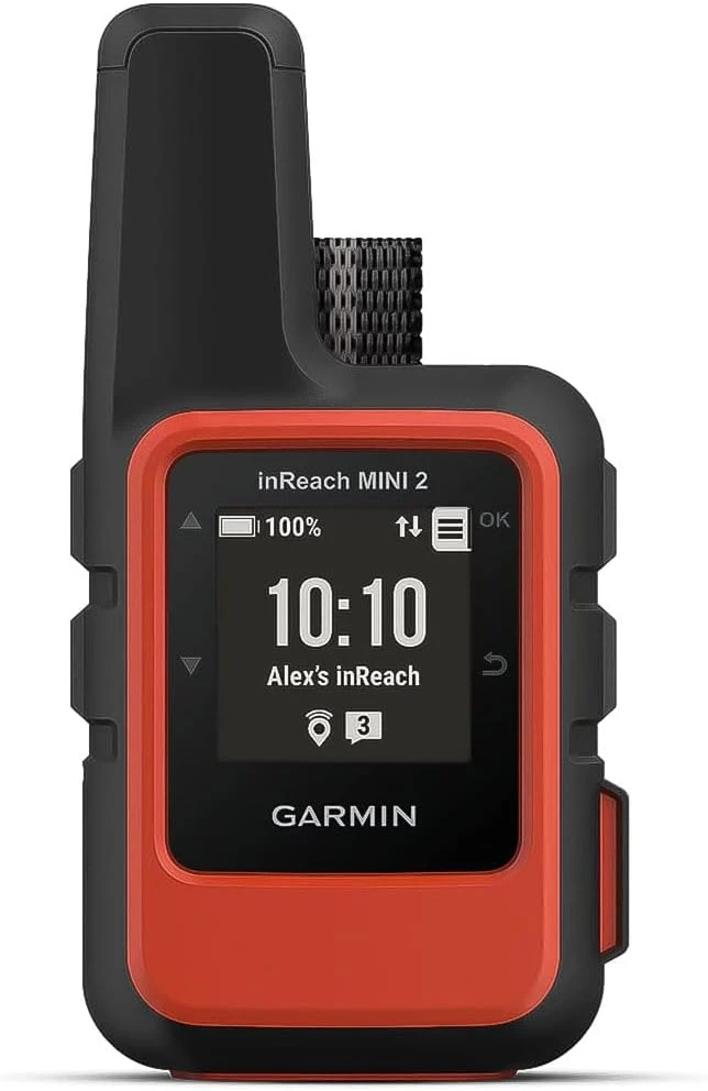
At just 3.5 oz, the inReach Mini 2 is one of the lightest ways to add satellite SOS and two-way messaging to your kit.
It's primarily a communicator (the small screen isn't ideal for detailed map navigation), but it tracks your position
and pairs with your smartphone for full mapping via Garmin Explore.
Display: 1.3" monochrome (basic position display)
Battery: 14 days (10-min tracking), 30 days Expedition mode
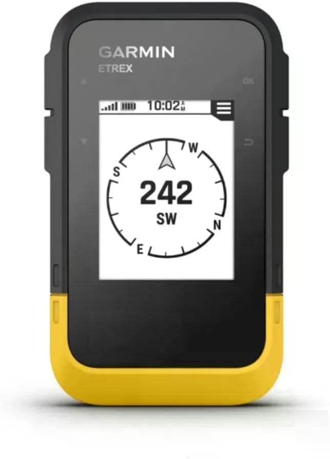
The eTrex Touch modernizes the classic eTrex concept with a more intuitive touchscreen-style interface while keeping
a compact, trail-friendly form factor. It's built for hikers who want easier on-device interaction than button-only
handhelds without jumping to a heavy, vehicle-first unit.
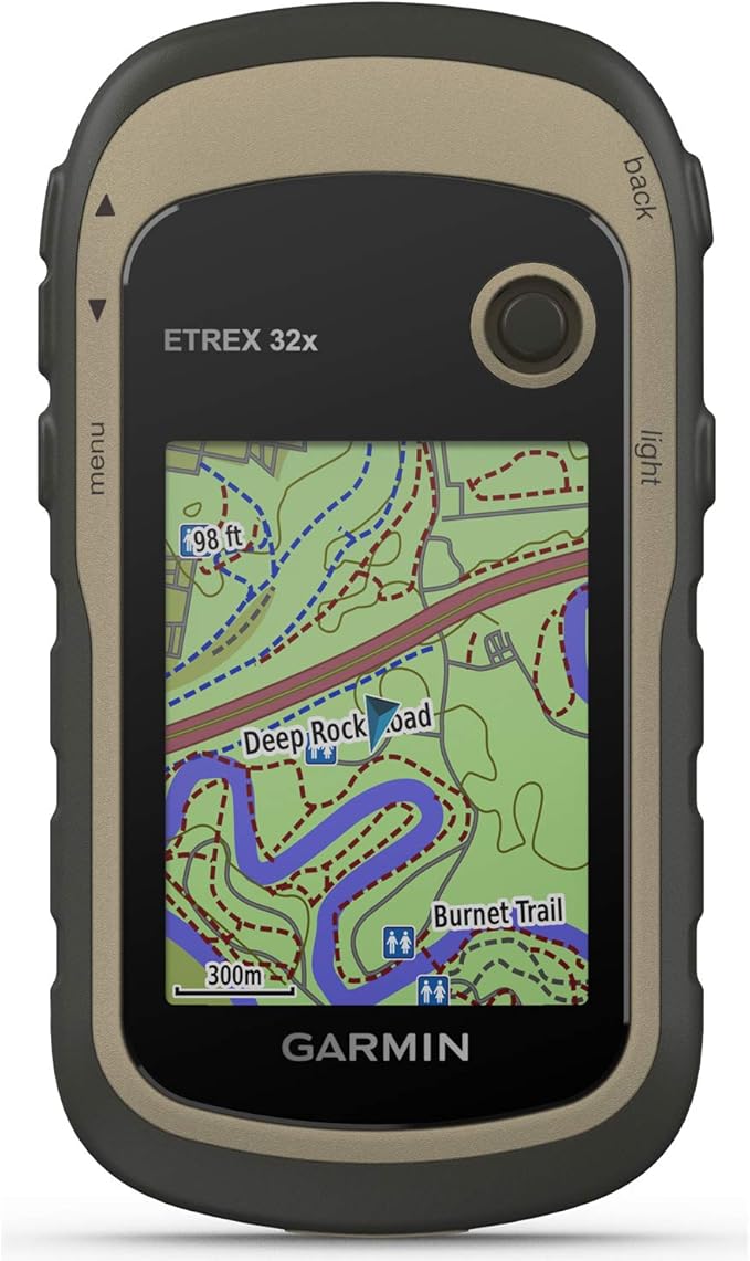
The eTrex 32x is a proven workhorse that packs a color display, preloaded maps, a 3-axis compass, and a barometric
altimeter into a compact body. Button controls work reliably with gloves and in wet conditions, making it a strong
value pick for hikers and geocachers.
Display: 2.2" color (240×320px), sunlight-readable
Battery: 25 hours (2× AA batteries)
Weight: 5.6 oz (160g)
GNSS: GPS/GLONASS
Sensors: 3-axis compass, barometric altimeter
Memory: 8GB internal + microSD slot
Durability: IPX7 waterproof
Field take: Reliable, simple, and AA-powered—great for folks who value durability over flashy UI.
Pros
Excellent value: maps + sensors in a compact unit.
Buttons are dependable in cold and wet weather.
AA batteries are easy to replace on long trips.
Cons
Single-band GNSS vs newer multi-band flagships.
Interface feels dated compared to touch models.
Verdict: The classic "no drama" GPS pick for reliable navigation at a reasonable price.
A dependable AA-powered handheld with mapping and sensors—an easy value recommendation for most hikers.
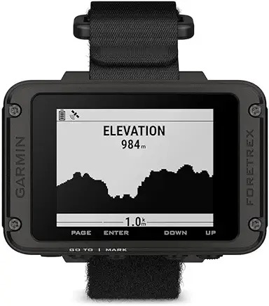
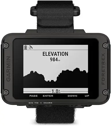
The Foretrex 801 is a wrist-mounted GPS designed for hands-free navigation. Built with rugged, tactical-friendly
features, it focuses on waypoints, tracks, and breadcrumb guidance rather than full on-device mapping—ideal for users
who want navigation data without holding a handheld.
Display: 2.2" monochrome (no maps, waypoint/track display)
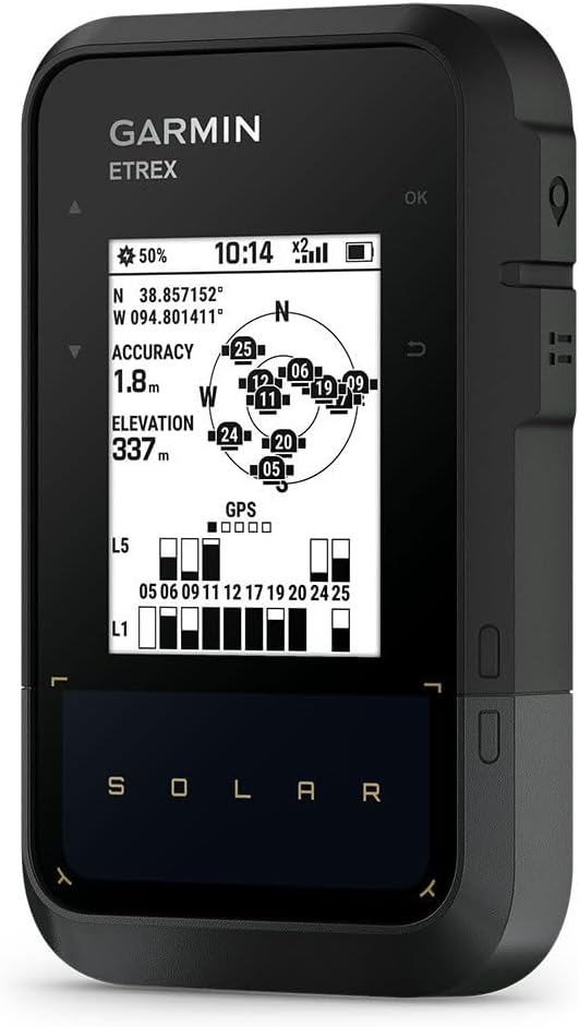
The eTrex Solar integrates solar charging to stretch runtime dramatically on sunny trips. It's built for long-distance
hiking and extended off-grid travel where charging is difficult. It focuses on core navigation features and strong
endurance rather than a complex, map-heavy interface.
Display: 2.2" color with integrated solar panel
Battery: 200 hours (unlimited with solar), AA batteries
Weight: 5.0 oz (142g)
GNSS: Multi-band GPS/GLONASS/Galileo/QZSS/BeiDou
Sensors: Digital compass
Memory: 28MB internal
Durability: IPX7 waterproof
Field take: Solar is great on exposed routes; expect standard battery behavior in dense forest or deep canyons.
Pros
Solar charging reduces "battery anxiety" on long trips.
Lightweight and AA-friendly for resupplies.
Solid accuracy potential with multi-constellation GNSS.
Cons
Solar benefit depends heavily on direct sunlight exposure.
Very limited internal memory versus map-heavy devices.
Verdict: Best "set-and-forget" option for long trips where charging is the main headache.
A long-runtime GPS that shines when sun exposure is high and charging options are limited.
The eTrex SE emphasizes long battery life and simple breadcrumb navigation. It's a great budget option if you want a
dedicated device that logs tracks for days and plays nicely with a phone for richer map viewing, without paying for
premium features you don't need.
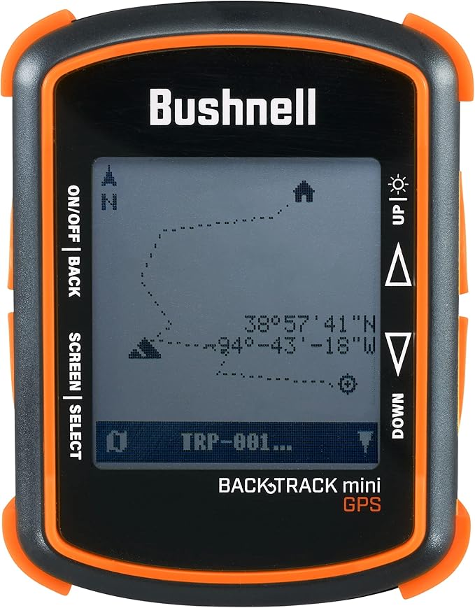
The BackTrack Mini is designed for simple breadcrumb navigation—mark a starting point and follow guidance back.
No topo maps or routing; it's a straightforward "return-to-start" backup option for casual users who want an extra
safety layer without learning a complex device.
Multi-band GNSS (found in GPSMAP 65s/67i, H1i Plus, eTrex Touch, Foretrex 801, eTrex Solar)
tracks satellites on multiple frequency bands simultaneously. This dramatically improves accuracy in
challenging conditions—under heavy tree canopy, in canyons, near tall buildings. In our testing, multi-band
units maintained 3-5 meter accuracy where standard GPS units drifted to 10-15 meters.
Standard GNSS (Montana 700i, inReach Mini 2, eTrex 32x) uses single-frequency tracking.
Still accurate in open terrain, but expect more drift in difficult conditions. Fine for most trail hiking;
multi-band matters most for off-trail navigation and precise waypoint marking.
Satellite Messaging: Do You Need It?
inReach satellite messaging (found on GPSMAP 67i, H1i Plus, Montana 700i, inReach Mini 2) provides two-way
text communication and SOS anywhere on Earth via the Iridium satellite network. Subscription plans vary by
tier and usage.
You need satellite comms if:
You regularly hike in areas without cell coverage
You solo hike and want emergency backup
Family/friends need regular check-ins for peace of mind
Your activities carry inherent risk (mountaineering, backcountry skiing, etc.)
You can skip it if:
You primarily hike popular trails with eventual cell coverage
You always hike with a group
You want to minimize ongoing subscription costs
You already carry a separate satellite communicator (PLB, SPOT, etc.)
Battery Life Considerations
GPS battery life varies wildly based on usage patterns. Manufacturer specs assume specific duty cycles
(often 10% tracking, 90% standby). Real-world hiking—with frequent screen checks, waypoint marking, and
occasional messaging—typically delivers 50-70% of rated battery life.
180+ hours: GPSMAP 67i, eTrex SE — multi-week trips possible
25-35 hours: eTrex 32x, Montana 700i — need daily/frequent recharging
16 hours: GPSMAP 65s — carry spare AA batteries for extended trips
Pro tip: Expedition mode (available on most Garmin units) drastically extends battery by
reducing GPS logging frequency. Great for long trips where you just need periodic position updates.
Touchscreen vs Button Controls
Touchscreen (Montana 700i, eTrex Touch, H1i Plus): More intuitive for panning/zooming maps,
faster text entry for messages, smartphone-like experience. Downsides: harder to use with thick gloves,
can struggle in heavy rain, typically more battery drain.
Button controls (GPSMAP 65s/67i, eTrex 32x/SE, Foretrex): Work flawlessly with gloves, in
rain, and in cold. Better battery efficiency. Downsides: slower map navigation, steeper learning curve,
tedious text entry.
Hybrid (H1i Plus): The new H1i Plus offers both touchscreen and physical buttons—the best
of both worlds if you can afford the premium price.
🔬 How We Research & Evaluate GPS Devices
Our evaluation process combines hands-on experience, detailed specification analysis, and aggregated user feedback to deliver honest, real-world recommendations:
Accuracy Evaluation
Multi-terrain performance: User-reported accuracy in dense forest, canyons, alpine ridges, and urban environments
Satellite lock times: Manufacturer specs verified against owner-reported cold/warm start times
Track accuracy: Documented precision compared against user expectations and reference standards
Multi-band verification: Reported accuracy improvements from multi-band GNSS vs standard GPS
Battery Life Analysis
Real-world drain: Manufacturer specs compared against owner-reported runtime under hiking conditions
Expedition mode performance: User feedback on low-power tracking modes for multi-day trips
Cold weather impact: Documented battery capacity loss in freezing conditions (Li-ion loses 20-40%)
Satellite messaging drain: Reported battery impact from inReach message usage
Durability Assessment
Weather resistance: User reports on IPX7/IP67 performance in rain and submersion
Drop durability: Owner feedback on survival from pack-height drops
Screen quality: Scratch resistance and sunlight readability reports
Usability: Feedback on operation with wet hands, gloves, and in cold conditions
Navigation Feature Assessment
Map quality: User ratings of preloaded TopoActive maps for trail accuracy
Route planning: Feedback on waypoint creation, course following, and re-routing
Sensor accuracy: Owner reports on barometric altimeter and compass reliability
App integration: Garmin Explore pairing, sync, and workflow usability
📊 Our Approach: Where possible, we evaluate devices firsthand. For devices we haven't personally tested, we rely on thorough specification analysis, manufacturer documentation, and verified owner feedback. We prioritize retail availability, avoid pay-for-play placements, and update picks when new models change the landscape.
Last updated: December 28, 2025 | Next review cycle: March 2026
🚫 5 Costly Mistakes to Avoid When Buying a GPS
Assuming your phone is enough
Phones work great until they don't. Battery drains fast with GPS active, screens are unreadable in
bright sun, they're not waterproof, and they die in cold weather. A dedicated GPS is a $150-600
insurance policy that could save your life when your phone fails at the worst moment.
Buying inReach without understanding subscription costs
inReach-equipped GPS units add ongoing subscription costs. Over a few years, the subscription can rival
(or exceed) the cost of the device itself. If you rarely go off-grid, consider a non-inReach GPS and a
separate PLB for emergencies—lower ongoing costs.
Overbuying features you won't use
The Montana 700i's massive screen is amazing—but at 14.5 oz, will you actually carry it hiking?
The H1i Plus's voice messaging is revolutionary—but do you need it for day hikes? Match the device
to your actual use case, not the coolest features.
Ignoring battery life for your trip length
A 16-hour battery (GPSMAP 65s) or 25-hour battery (eTrex 32x) means daily charging or carrying spare AA batteries on a week-long trip. A 180-hour battery (GPSMAP 67i)
means no charging at all. Factor in cold weather reducing capacity 20-40%. If you can't recharge,
battery life is your #1 priority—or choose units with replaceable AA batteries.
Not testing before you need it
GPS devices have learning curves. Take your new unit on familiar trails first. Learn to mark waypoints,
follow tracks, and navigate menus before you're in the backcountry depending on it. This includes
testing satellite messaging—send some inReach texts before you're in an emergency.
🛰️ Multi-Band GNSS Technology Explained
Modern GPS devices don't just use GPS—they track multiple satellite constellations simultaneously for
better accuracy and faster satellite lock times.
Satellite Constellations
GPS (USA): The original system, 31 satellites. Still the backbone of positioning.
GLONASS (Russia): 24 satellites. Combined with GPS for faster fixes and better coverage.
Galileo (Europe): 30 satellites. Excellent accuracy, especially in urban environments.
QZSS (Japan): 4 satellites. Regional system enhancing accuracy in Japan/Oceania.
IRNSS (India): 7 satellites. Regional system for South Asia.
What "Multi-Band" Means
Each satellite broadcasts on multiple frequencies (L1, L2, L5, etc.). Standard GPS receivers only use
one frequency (L1). Multi-band receivers track multiple frequencies simultaneously, which allows them to:
Correct for ionospheric delays more accurately
Maintain signal lock in difficult conditions (canopy, canyons)
Achieve 3-5 meter accuracy vs 10-15 meters for single-band
Lock onto satellites faster in cold starts
💡 SatIQ Technology: Garmin's SatIQ automatically adjusts which satellite bands to track
based on conditions, optimizing the balance between accuracy and battery life. Found on GPSMAP 67i,
H1i Plus, and eTrex Touch.
📡 Complete inReach Satellite Messaging Guide
What inReach Does
inReach uses the Iridium satellite network for two-way text messaging and emergency SOS from anywhere
on Earth—even where there's no cell coverage. You can send preset messages, custom texts, and location
updates to any email or phone number. In emergencies, the SOS button connects directly to GEOS, a 24/7
monitoring center that coordinates rescue.
Subscription Plans (2026 Pricing)
Safety (entry tier): SOS only, no two-way messaging. Minimum for emergency backup.
Recreation (mid tier): 40 messages/month, 10-minute tracking. Good for most users.
Expedition (top tier): Unlimited messages, 2-minute tracking. For serious expeditions.
Plans typically run about $15–$65/month depending on tier. Annual plans offer ~25% savings. You can suspend service during off-seasons for a small fee and reactivate when needed.
inReach vs inReach Plus (H1i Plus)
The new inReach Plus on the GPSMAP H1i Plus adds revolutionary capabilities:
Voice messages: Record and send voice memos via satellite
Photo messaging: Send compressed photos from the built-in camera
Higher bandwidth: Faster message delivery
Standard inReach (67i, Mini 2, Montana 700i) is text-only.
Real-World inReach Experience
In our testing, message delivery typically takes 30-90 seconds with clear sky view. Under heavy canopy,
it can take 2-5 minutes as the device searches for satellite lock. The SOS function has near-perfect
reliability—Garmin reports 99.9%+ successful SOS delivery. Battery impact varies: sending a few messages
per day has minimal impact; continuous 10-minute tracking can cut battery life by 30-40%.
❓ Frequently Asked Questions
What is the best handheld GPS in 2026?
The Garmin GPSMAP 67i is our top overall pick. It combines
best-in-class multi-band GNSS accuracy, exceptional 180-hour battery life, and built-in inReach
satellite messaging. For most serious hikers and backpackers, it's the gold standard.
Do I really need a dedicated GPS if I have a smartphone?
For serious outdoor use, yes. Smartphones drain battery fast with GPS active (often 5-8 hours),
screens wash out in sunlight, they're not waterproof, and cold weather kills Li-ion batteries.
Dedicated GPS units offer 25-180+ hours of battery, sunlight-readable screens, and IPX7 waterproofing.
They also work independently of cell coverage for navigation.
What's the difference between inReach and a PLB?
inReach provides two-way messaging (you can send/receive texts) plus SOS. Requires
monthly subscription (typically $15–$65/month depending on tier). PLBs (Personal Locator Beacons) are SOS-only with no
messaging—one-time purchase, no subscription, but you can only send distress signals, not check-ins
or custom messages. inReach is more versatile; PLBs are simpler and cheaper long-term.
How accurate are handheld GPS devices?
Multi-band GNSS devices (GPSMAP 65s/67i, H1i Plus, eTrex Touch) typically achieve 3-5 meter accuracy
in open conditions and maintain 5-10 meters under tree canopy. Standard GPS units (eTrex 32x, Montana)
deliver 5-10 meters in open areas but can drift to 15+ meters in difficult conditions. All are
accurate enough for trail navigation; multi-band matters most for off-trail and precision work.
Can I use a GPS device without a subscription?
Absolutely. The GPSMAP 65s, eTrex Touch,
eTrex 32x, Foretrex 801,
eTrex Solar, and eTrex SE
all work completely standalone with no subscription. Only the inReach-equipped models (67i, H1i Plus,
Montana 700i, inReach Mini 2) require subscriptions, and that's only for the satellite messaging feature.
How long do GPS batteries really last?
Manufacturer specs assume ideal conditions (often 10% tracking, 90% standby). Real hiking use with
frequent screen checks, waypoint marking, and occasional messaging typically delivers 50-70% of rated
life. Based on user reports, the GPSMAP 67i typically delivers ~120-140 hours of actual hiking use (vs 180 hours
rated), the eTrex SE delivered ~100-120 hours (vs 168 rated). Cold weather reduces all batteries by
20-40%, so plan accordingly for winter trips.
Which GPS is best for beginners?
The eTrex Touch offers the most intuitive smartphone-like
interface with its touchscreen. For budget beginners, the eTrex SE
is simple and reliable, pairing with the free Garmin Explore app for mapping. Both have excellent
accuracy and enough features without overwhelming complexity.
Can I download maps to a handheld GPS?
Yes. Most Garmin units come with preloaded TopoActive maps (USA, Canada, Mexico coverage). You can
download additional maps via the free Garmin Explore app or purchase premium options like BirdsEye
satellite imagery. Units with microSD slots (GPSMAP 65s/67i, Montana 700i, eTrex 32x) allow expandable
storage for additional map sets. The eTrex SE has limited internal memory and relies more on phone app pairing.
What's the best GPS for hunting?
The GPSMAP H1i Plus was specifically designed for hunting
with its dual cameras, voice messaging, and Hunt/Fish activity profiles. For budget hunters, the
Foretrex 801 provides hands-free wrist navigation with 100-hour
battery. The GPSMAP 67i is the reliable middle ground with
inReach safety backup.
Are Garmin GPS devices waterproof?
Yes. All devices on this list are rated IPX7 or IP67, meaning they can withstand submersion in 1 meter
of water for 30 minutes. This covers rain, stream crossings, and accidental drops in water. However,
none are rated for swimming or diving. The Montana 700i's touchscreen can be finicky in heavy rain
(water droplets register as touches), while button-operated units work flawlessly in all wet conditions.
👤 About the Author
I’m Michael Taft, founder of Products For Our Lives. This site exists to share the same research and testing my son and I do before buying gear we actually use—especially equipment we depend on when we’re outdoors.
Our interest in handheld GPS units grew out of real use. We regularly go geocaching locally, which sparked an appreciation for accurate navigation and dependable tracking. That interest turned into a deeper need when we started planning hiking trips to places like Wyoming, where cell service can’t be relied on and navigation mistakes matter. Those experiences pushed me to research and compare GPS devices more seriously.
Expertise: outdoor navigation gear, reliability-first comparisons, real-world trail use
Methodology: I compare satellite support, reception under tree cover and terrain, mapping workflows, battery type and life, durability ratings, and ease of use with gloves or in cold conditions. I verify specifications against manufacturer documentation and weigh consistent long-term owner feedback to surface reliability patterns.