How I Got Pulled Into Beyond the Map's Edge
A single text from my sister is all it took to pull me into the world of modern treasure hunting. She sent me a link about Justin Posey and his treasure hunt, Beyond the Map's Edge, and from that moment, I was hooked. What started as harmless curiosity turned into hours of research, trail mapping, poem reading, and deep-dive community discussions about one of the most captivating treasure hunts in years.
Obsessed: From Clue-Hunting to Community
Within days, I found myself absorbed in everything related to the hunt—analyzing poem structure, following updates from seasoned hunters, and studying potential search zones across the American West. I connected with treasure hunters in Montana and Wyoming and learned how much collaboration shapes big discoveries. It’s not just a puzzle; it’s a growing community of outdoor lovers, map nerds, and adventure-driven families all chasing the mystery of Beyond the Map's Edge.
Planning My Trip—and the Gear I’ll Need
As I planned my own hunt, I quickly learned how essential the right equipment is. The terrain in Posey’s hunt spans rugged mountains, open basins, dense forest, and high-elevation ridges. To stay safe and precise, I prepped with long-range walkie talkies , handheld GPS , weatherproof layers, trekking poles, and lightweight survival gear. For anyone heading into potential search zones, reliable navigation tools and communication devices are absolute must-haves.
More Than Gold: What This Hunt Means to Me
For me, this journey became something deeper than decoding clues. It turned into a chance to explore the West, disconnect from daily life, and build unforgettable memories with my son. Treasure or no treasure, the miles we hiked, the laughs we shared, and the wild places we saw are worth more than any chest hidden beyond the map's edge.
Our Father–Son Treasure Hunt Trip Out West
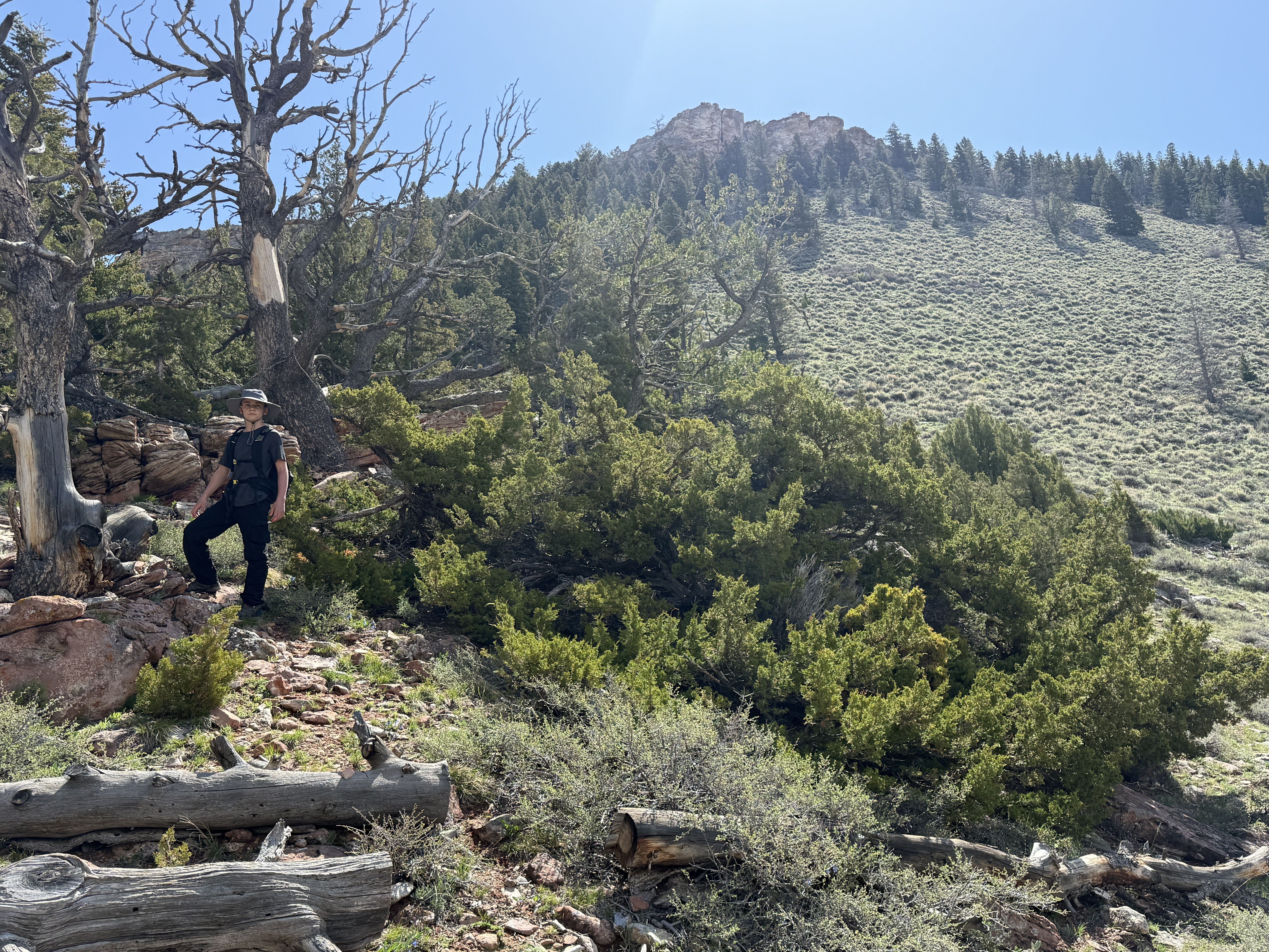
When my son and I finally headed west to chase the mystery of Justin Posey’s Beyond the Map’s Edge, we knew we were stepping into real adventure. Nothing compares to being out there together—just the two of us, our gear, the open sky, and a secret search zone we’re keeping quiet because we’re far from finished hunting. Every mile felt like a memory in the making.
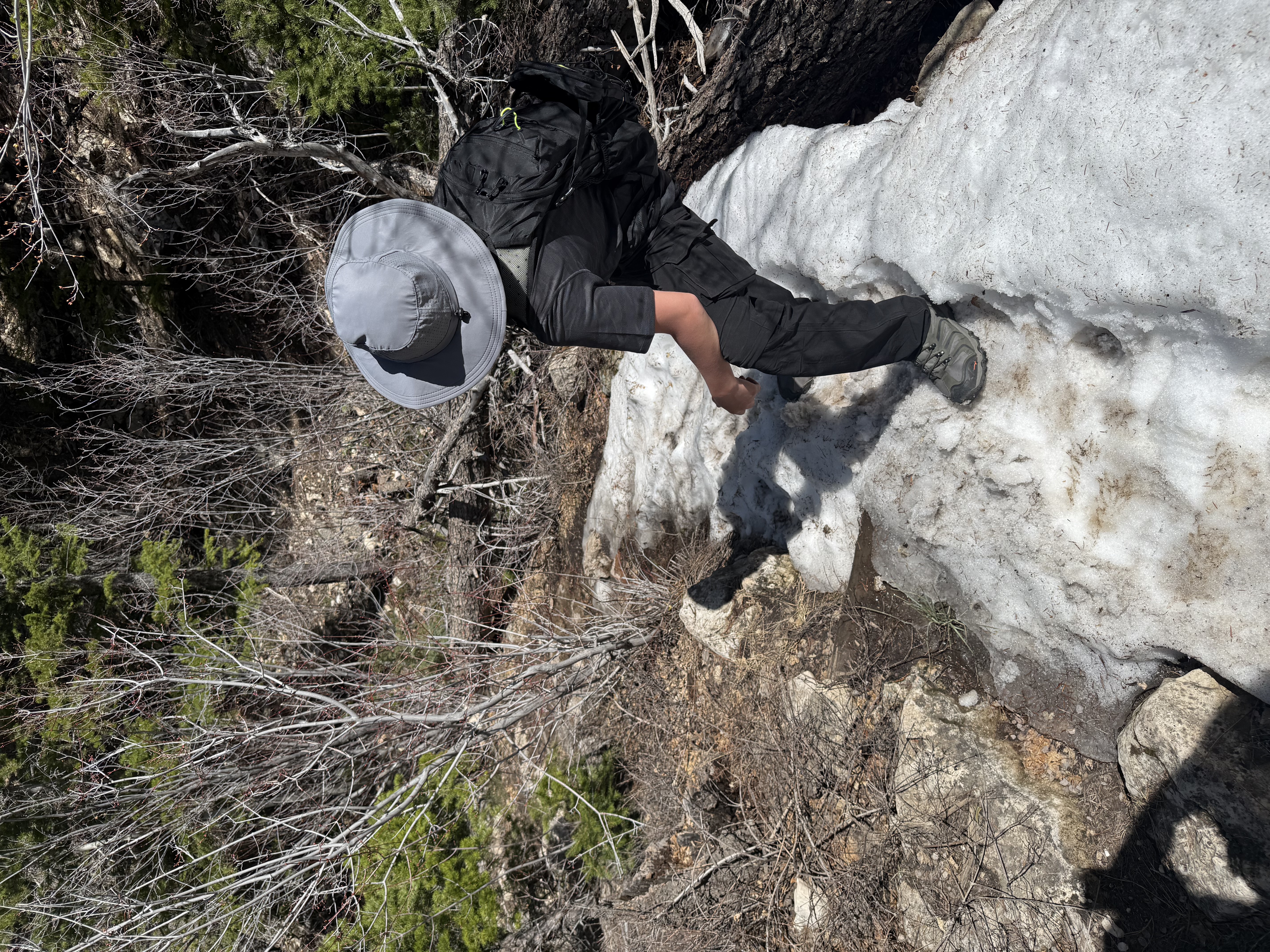
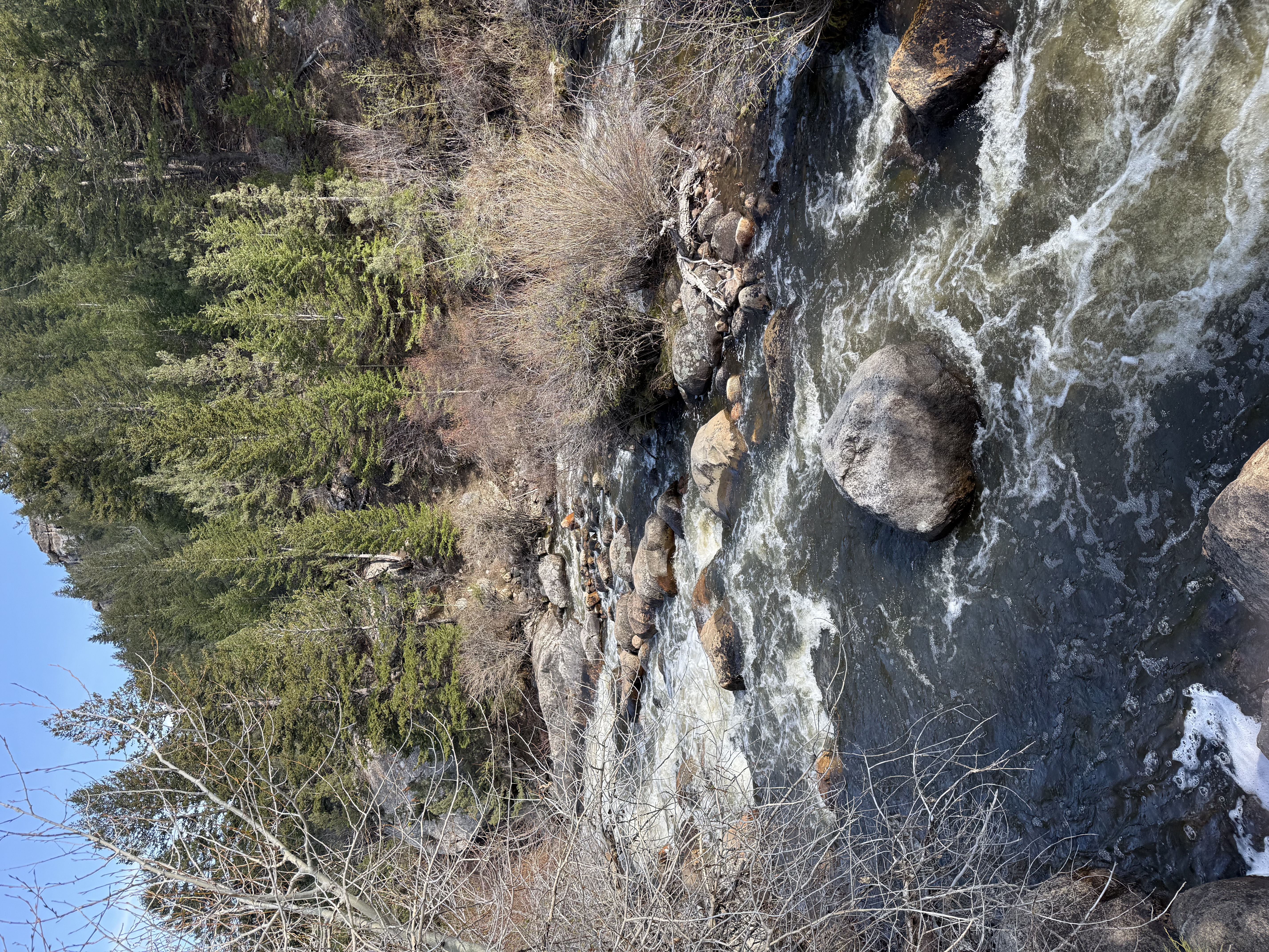
The plan sounded simple enough: take a taxi from the motel as far as the driver could legally go, hike a road mile or so, and then disappear into the wilderness with our long-range walkie talkies , handheld GPS , and printed maps. But without rental cars available anywhere in the area, we ended up logging far more miles than expected—up and down mountains, across old wooden bridges, through cold streams, and along narrow ridge lines that looked straight out of a movie. We were chasing hard target coordinates we had marked weeks earlier, but because of the travel limitations, we only reached a couple of them… which is exactly why we’ll be back once the snow melts.
We even had high hopes of live streaming our treasure hunt to family back home—letting them experience the hunt with us in real time—but the mountains had other plans. Cell service vanished the moment we stepped off the road. Honestly, the silence made the journey even more immersive.
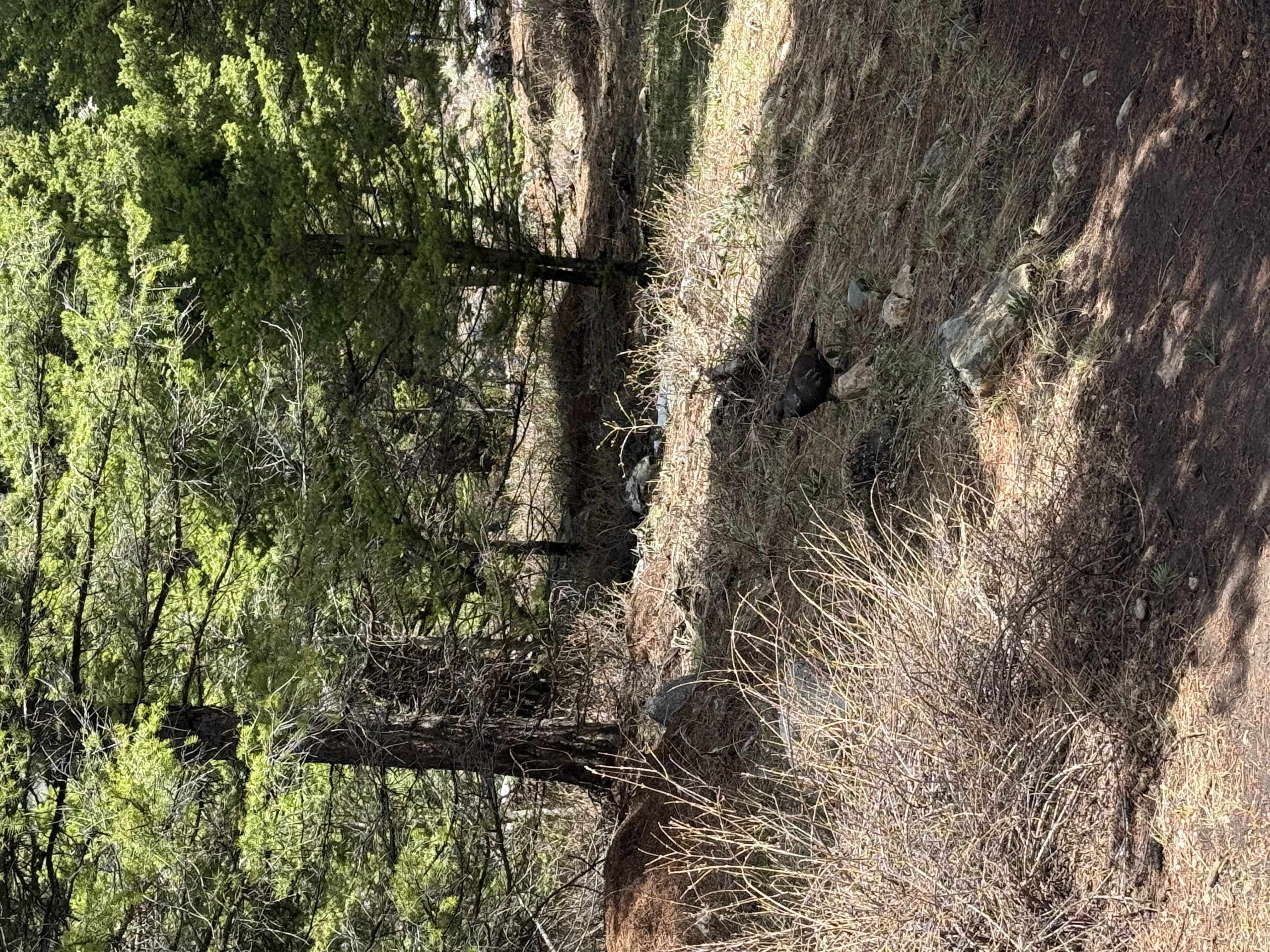
One of the wildest moments came when we were suddenly attacked by a sage grouse. The thing came out of nowhere, feathers out, charging like it owned the entire mountain. We got around it, finished our search, and thought the ordeal was behind us—until the hike back. Somehow, the grouse heard us talking and was waiting for round two, standing on the trail between two massive boulders like a feathery sentry. Not wanting to square up with an angry bird again, we looped completely off the trail. That detour caused us to miss our pickup time, but fate stepped in. A kind couple driving by offered us a ride back toward town, saving us hours of additional walking.
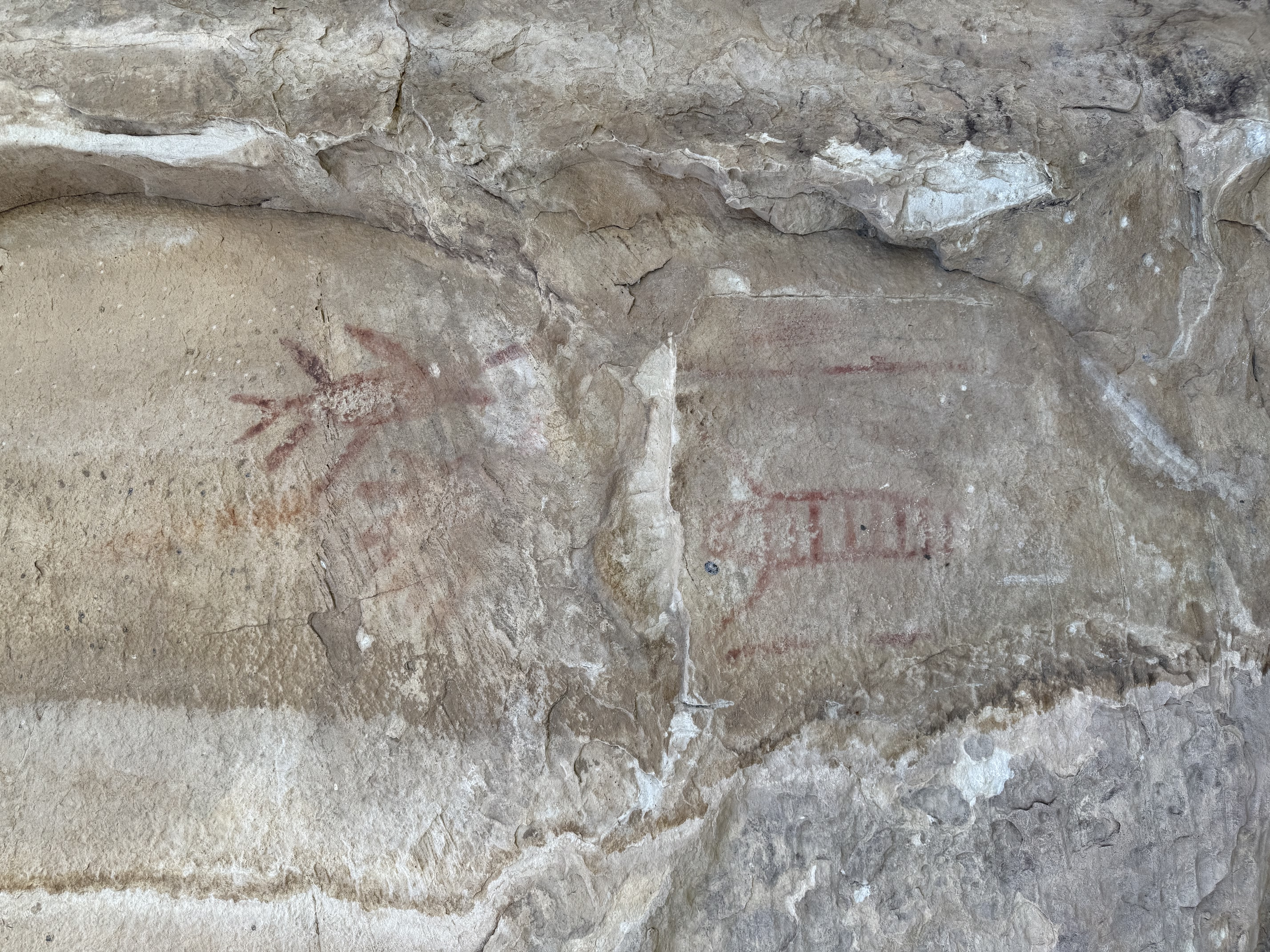
Funny enough, that unexpected extra walk is what led us to one of the coolest discoveries of the entire trip. Tucked along a rock face were ancient-looking hieroglyphs carved into the mountain itself—something we would have totally missed if that grouse hadn’t gone full UFC on us. Treasure or no treasure, moments like that remind you why these hunts are so addictive.
The time my son and I spent together out there—navigating trails, sharing laughs, spotting wildlife, comparing map notes, and pushing through exhaustion—is something I’ll never forget. These memories can’t be replaced, and they mean more to me than any treasure chest hidden beyond the map’s edge. And because we still have unsearched coordinates waiting for us, our hunt isn’t over. We’ll be back soon—with more gear, more determination, and hopefully fewer angry birds.
A few images from the treasure hunt.
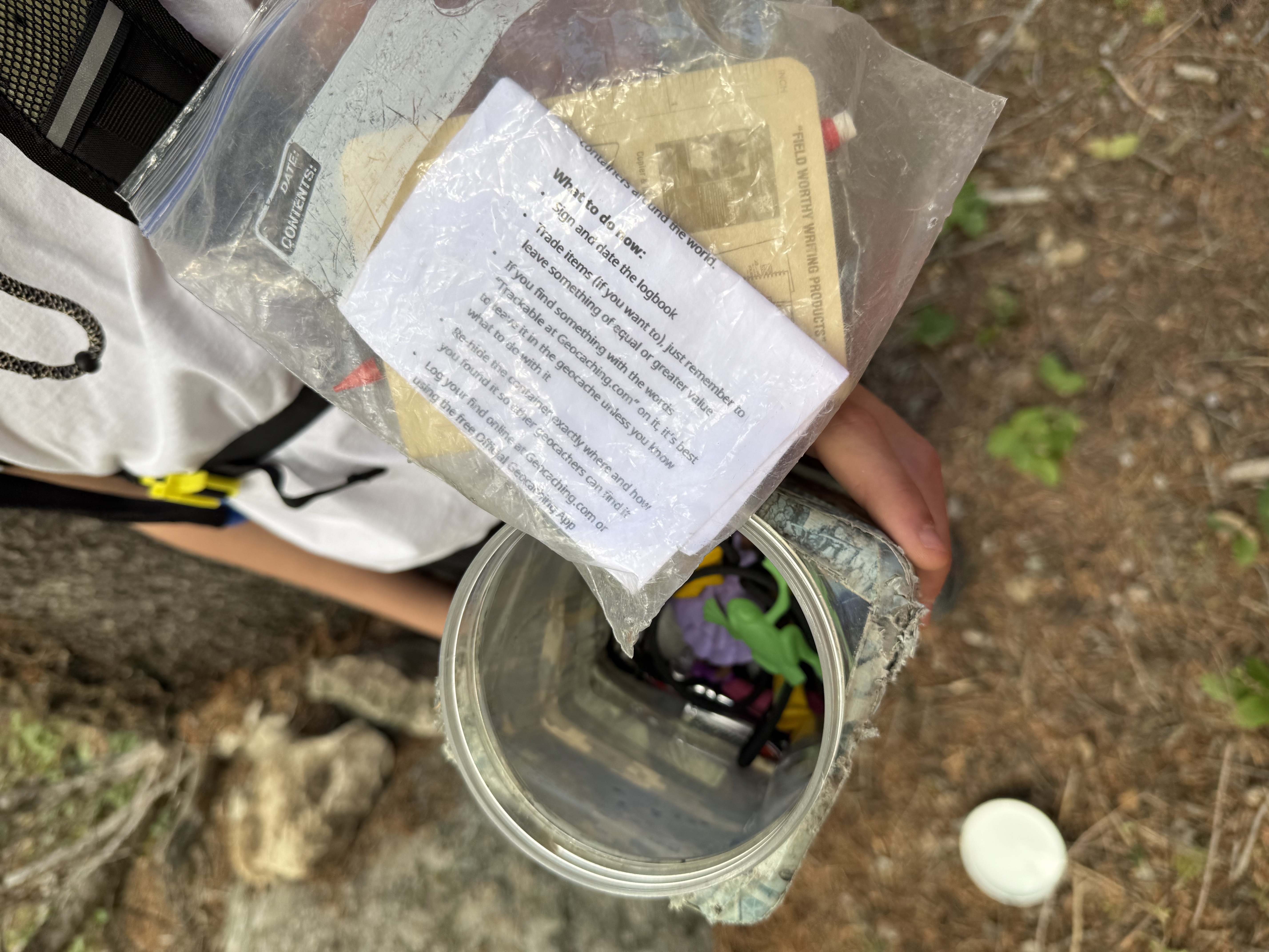
Gear We Took With Us
- My pick and personal Handheld GPS - Garmin GPSMAP 65s
- Small and light weight walkie talkies - Midland X-Talker T10
- The first aid kit we took. Simple yet packed with supplies.
- Compact binoculars made by Tasco
- Rechargable Headlamps in case we got caught out after dark.
Quick comms & nav picks (internal):
- Motorola T600 — IP67, floats; reliable when snow or creek crossings get messy.
- Midland GXT1000 — value GMRS/FRS with NOAA alerts for fast-changing mountain weather.
- Handheld GPS guide — how we pick offline navigation that actually works off-grid.
Hunt Updates & Trailhead Conditions – November 2025
Planning a hunt? Here’s an updated snapshot of early-season conditions across the Western U.S. as winter 2025–26 starts to take shape:
Sierra Nevada, California
- Early-season storms are rebuilding the high-country snowpack, with recent systems dropping several inches of new snow above roughly 6,000–6,500 ft.
- Snow levels have been oscillating between about 5,500 and 8,000 ft; expect mostly bare or wet ground at many lower trailheads and wintry travel higher up.
- High passes and basins are transitioning to full winter conditions—check current snow-survey maps and highway reports before committing to backcountry approaches.
Mount Hood National Forest, Oregon
- Barlow Pass: early-season conditions with patchy or minimal snow at the trailhead; snow coverage increases with elevation but remains shallow compared to midwinter.
- Bennett Pass: variable, thin snowpack—expect a mix of bare ground, ice, and wind-drifted patches rather than continuous deep snow; winter grooming is not yet consistent.
- White River West: mostly fall-like travel with isolated snow patches and frozen or wet surfaces; treat it as shoulder season rather than full snow travel.
Colorado Trail
- Unusually warm and dry November has left much of Colorado’s high country with only light natural snow so far; many SNOTEL sites are showing snow water equivalent well below normal for this date.
- Expect largely dry or intermittently snow-covered tread on lower segments, with winter conditions mainly confined to the highest passes—always verify SNOTEL and trail reports before any late-season push.
Mount Adams, Washington
- Potato Hill: early-season readings show just a few inches of snow at the SNOTEL site, with snowpack only beginning to develop.
- Higher, north-facing slopes on Mount Adams are accumulating more snow, and travel will trend toward full winter conditions into December; expect increasing ice and snow on approach roads and upper trails.
Wyoming
- In the Yellowstone region, early-November measurements put snowpack around three-quarters of normal, with substantial snow on high plateaus and along the Continental Divide.
- Trails above roughly 7,000 ft are quickly becoming fully snow-covered; lower valleys see patchy snow and ice with occasional high runoff near creeks during warm spells.
Montana
- NRCS SNOTEL data from western Montana basins show early-season snow water equivalent near to modestly below median in many mountain areas.
- Trails around 6,000 ft and above are increasingly snow-covered, while lower routes alternate between bare ground, mud, and thin, icy patches—plan for slippery footing.
Utah
- Uinta Mountains: developing snowpack of roughly 6–12 inches in many areas above 9,500 ft after mid-November storms, with more accumulation expected—winter travel gear and avalanche awareness are essential.
- Zion and Moab areas remain mostly dry and accessible, though passing systems can bring rain or light snow and create short-lived muddy, slick trail conditions on exposed rock and clay soils.
Always check the latest local forecasts, avalanche advisories, road reports, and land-management alerts before your trek, and pack for true winter travel at higher elevations.
FAQ: Beyond the Map's Edge & Backcountry Prep
What radios work best for this hunt?
IP-rated GMRS/FRS handhelds with solid battery life. We like the Motorola T600 and Midland GXT1000 for wet, mixed terrain.
Do I need offline navigation?
Yes. Cell service disappears fast—use a handheld GPS or download offline maps before leaving town.
How do you stay safe with surprise wildlife (like our grouse)?
Give wildlife space, keep an alternate route in mind, and use radios to regroup if you detour. Avoid blocking an animal’s exit.
Best way to log clues on trail?
Carry a waterproof notebook and snap quick photos. If you use a radio with messaging (e.g., Motorola T802), send short notes to teammates.
What about winter approaches?
Check SNOTEL/highway reports, pack traction, and scale plans if snow or ice makes routes unsafe.
